
Charged Horizons, Hand-Drawn Roads
Seeing the Whole Journey at Once
Symbols, Colors, and Notes that Stick
Range Awareness You Can Feel
The 20–80 Habit
Fast chargers deliver their best between roughly 10–80 percent state of charge, yet arriving near 20 percent typically balances flexibility and comfort. Plan legs that target departures around 70–80 percent when practical, allowing quick top-ups and shorter stops. This rhythm minimizes time at tapering speeds, preserves pack health, and invites frequent scenic breaks at overlooks or cafes. On paper, mark legs designed for that cadence, then add alternates that preserve margins if headwinds, traffic, or irresistible side roads extend your day unexpectedly.
Speed, Temperature, and the Truth About Consumption
Drag rises with the square of speed, and power demand can climb steeply, so five extra miles per hour may cost more than you think. Cold reduces usable capacity and increases cabin heating loads; heat can stress cooling systems. Precondition near chargers when possible, and dress your schedule for the weather as thoughtfully as your wardrobe. On paper, annotate expected averages for each segment, then write conservative estimates on exposed highlands or open plains. This keeps plans honest, resilient, and surprisingly liberating.
Proactive Buffers Beat Heroics
Build safety margins while you still have options. Arrive at remote chargers with comfortable reserves, especially before climbs or night driving. If terrain, storms, or closures threaten your best line, buffers let you choose beauty over urgency. Mark bailout towns, slower but certain Level 2 opportunities, and places to rest while topping up. Turning panic miles into patient minutes changes everything; your crew enjoys impromptu museums or trails, and your battery thanks you. Confidence grows when you design it intentionally on the page.
Curating Beauty: Byways, Parks, and Coastal Loops
Layering Scenic Databases onto Paper Pages
Cross-reference National Scenic Byways, state park guides, and cycling route maps against your atlas. Many celebrated roads align with gentler grades and charming towns, naturally suiting electric pacing. Print small index cards with byway highlights, then tape them near relevant map margins. Add charger types, typical availability windows, and viewpoints a short walk from parking. This low-tech layering sharpens decisions at intersections and invites informed spontaneity, helping you choose between two beautiful options with clarity rather than guesswork or last-minute scrolling.
Story-Driven Detours
Give every day a narrative arc. Maybe you chase old lighthouses, mural towns, covered bridges, or farm-to-table suppers. Paper makes motifs tangible: sketch icons, underline relevant notes, and tag local historians or ranger stations to call. Your route becomes a living scrapbook where energy stops feel purposeful, not obligatory. When friends join mid-trip, they instantly grasp the plot by scanning your pages. Stories tie distances together, transform chargers into chapter breaks, and turn miles into memories that feel carefully crafted, never hurried.
Timing the Golden Hours
Sunrise and sunset reward patient planners. Use your atlas to estimate ridge orientations, coastal angles, and lake reflections, then align charging breaks near trailheads or overlooks just before those moments. Slow down earlier in the afternoon to arrive unhurried, with a warm drink and an extra sweater ready. Jot civil twilight times, moon phases, and safe pullouts on the margins. When light and energy sync, photos glow, conversations deepen, and your battery rests while the horizon does its quiet, generous magic.
Terrain and Weather: The Invisible Battery Tax
Charging Without Guesswork
Know Your Connectors and Speeds
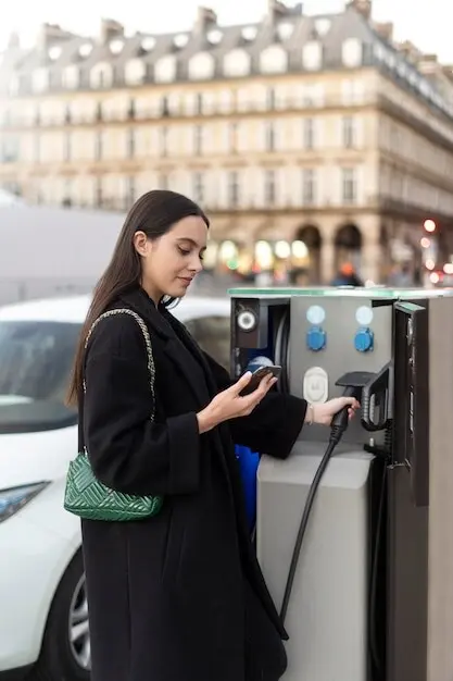
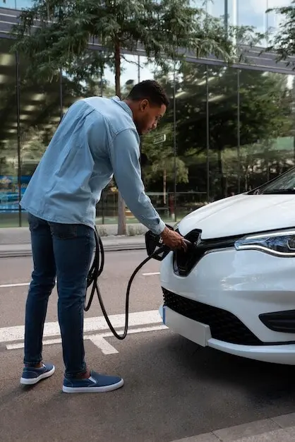
Familiarize yourself with DC fast standards like CCS and NACS, and legacy options such as CHAdeMO where they still serve travelers. Level 2 offers dependable overnight or long-meal replenishment; fast charging excels for mid-leg boosts. Note charger counts, access hours, and amenities. Arrive warm when possible for better rates, and plan to leave as taper begins. Document these details beside each town on your map. Clarity about cables and kilowatts keeps conversations upbeat and decisions quick when daylight or weather tightens.
Paper-First Stop Selection
Choose towns that offer more than electrons. Libraries, museums, waterfront walks, and local diners transform waiting into welcome. Call to confirm parking policies and charger reliability, then pencil operating notes directly onto your atlas. Align stops with scenic detours, so if queues appear you still win the hour. Mark rest-friendly parks for Level 2 top-ups during picnics. By designing delight into every potential pause, you eliminate resentment and build momentum. Your pages become a compass for both energy and happiness.
Staying Productive While You Top Up
Treat charging as intentional intermissions. Pack a book, a compact sketch kit, or a camera checklist for nearby murals and riverwalks. Stretch, hydrate, and review the next leg’s climbs, winds, and buffers with a calm mind. If a station disappoints, your paper backups point to options that add value rather than frustration. Jot quick reflections beside each stop—coffee quality, trail conditions, friendly staff—so future routes grow richer. Engagement turns kilowatts into memories, making logistics feel like part of the adventure’s heart.
Map Craft: Building a Portable Planning Kit

All Rights Reserved.